
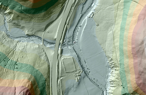
Since 1998 the Environment Agency has used lasers to scan and map the English landscape from above to help with work such as flood modelling and tracking changing coastlines. But these LIDAR (Light Detection and Ranging) data are also publically available and have been used to help with everything from building virtual worlds to managing forests. This LIDAR data bonanza has proved particularly helpful to archaeologists seeking to map Roman roads that have been ‘lost’, some for thousands of years. Their discoveries are giving clues to a neglected chapter in the history of Roman Britain: the roads built to help Rome’s legions conquer and control northern England.

https://www.gov.uk/government/news/lasers-reveal-lost-roman-roads